Walks
in the area
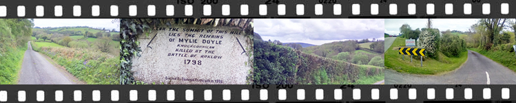
Slí
na Sláinte Illustrated Walk
An
illustrated walk by Dan Murphy giving
the history of the area with photographs.
Click on the image below.
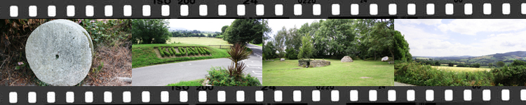
Kildavin Loop
An
8 Kilometer walk around Kildavin and the surrounding
area by Enda Smyth with photogaphs and history. Click
on the image below.
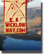 The Wicklow Way
The Wicklow Way is a 127 Kilometer Walk from Clonegal
to Marley Park in Dublin. The walk travels through the
counties of Carlow, Wicklow and Dublin.
For
further information on the Wicklow Way please click here.
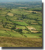 The
South Leinster Way
The
South Leinster Way
The South
Leinster Way is a long distance walking route which runs from Kildavin Co.
Carlow to Carrick-on-Suir in Co. Tipperary covering 102 km (64 miles) in length.
The predominant features in the landscape are Mount Leinster, Brandon Hill
and the river valleys of the Barrow, Nore and Suir. (The Three Sisters) This
stretch can be comfortably walked in five days but strong walkers can finish
it in three days.
 Slí na
Sláinte (by
the Irish Heart Foundation)
Slí na
Sláinte (by
the Irish Heart Foundation)
Slí na
Sláinte, meaning "Path to Health",
is a simple innovative scheme developed by the
Irish Heart Foundation to encourage people of all
ages and abilities to walk for leisure and good
health.
It
uses attractive signage at kilometre intervals on established
walking routes to help walkers identify the distance they
walk. Slí na Sláinte is designed to encourage
people to walk more frequently and to enjoy the benefits
of a healthier lifestyle.
To
View our Local Sli na Slainte please click on the image
This
is a PDF document and Adobe Acrobat Reader is required to
view it.
To view other Sli na Slainte routes around Ireland please click here
Map
Guides
Maps
with guide-book and detailed 1/50,000 scale strip maps
packaged in plastic wallet. They provide information on
route finding, local and natural history.
Available
from:
EastWest Mapping,
Ballyredmond,
Clonegal,
Enniscorthy,
Co. Wexford.
Website: www.eastwestmapping.ie
Phone:
053-9377835 or from local tourist information offices.
Information Sheets are available from Failte Ireland.